Kay Ivey declares state of emergency ahead of winter storm
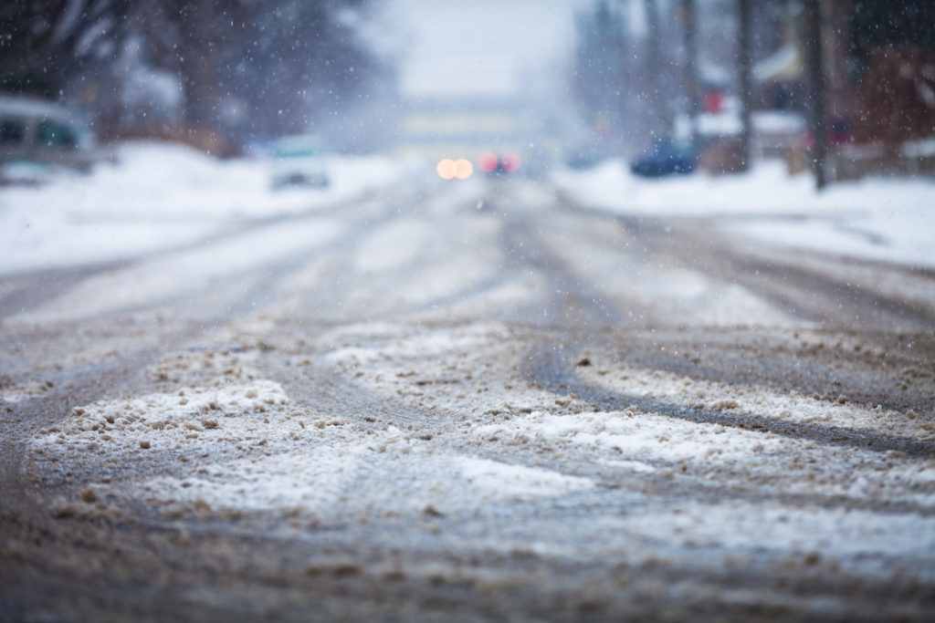
Alabama Gov. Kay Ivey issued a state of emergency ahead of a winter storm expected to bring snow and hazardous driving conditions to a large portion of the state. Ivey made the declaration Monday afternoon. The National Weather Service has issued a winter storm warning and winter weather advisory for much of the state. Forecasters said that that norther portion of the state could see hazardous driving conditions and up to three inches of snow. The governor’s office urged motorists to use extreme caution Ivey said the “winter storm has the potential to affect a large portion of our state.” Alabama Emergency Management Agency Director Brian Hastings said after the storm front passes, hazardous driving conditions will remain, particularly at night, as water freezes on roadways. Republished with permission from the Associated Press
‘Significant damage’ in Alabama after storms pummel Southeast
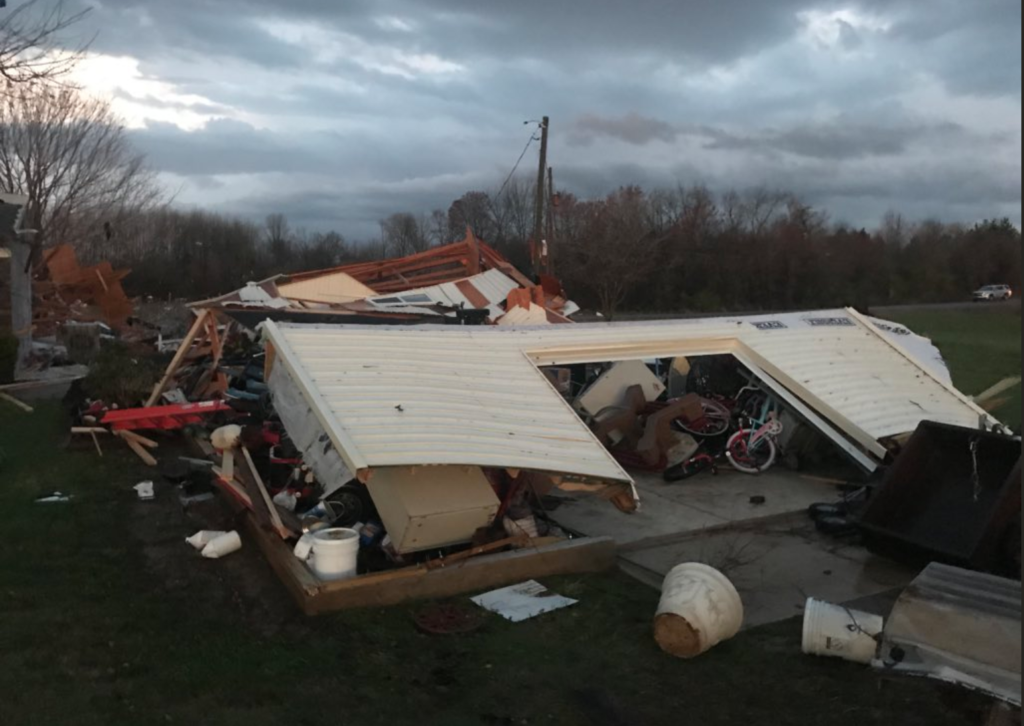
Severe storms pummeled the Yellowhammer State on Monday leaving destruction in its wake. After the night of violent weather, Alabama Power Co. confirmed more than 15,000 were without power throughout the night. As of 5:45 a.m., 9,000 homes and businesses still were. In Limestone County, Ala., the sheriff’s office tweeted photos of the the damage in Ardmore, Ala. showing several damaged homes and vehicles. Damage in Ardmore, AL pic.twitter.com/7mv3jmQMt3 — Limestone Sheriff (@LimestoneCoSO) March 20, 2018 Jacksonville State University, located in east Alabama, was one of the hardest hit locations in the state. There storms did major damage to the campus coliseum and several trees and power lines were downed. “We are still surveying all of the damage to campus and can confirm major roof damage to Logan Hall and Patterson Hall. Numerous trees and power lines are down. I’m very thankful JSU is on spring break this week and most students are out of town,” tweeted the university’s athletic director, Greg Seitz. We are still surveying all of the damage to campus and can confirm major roof damage to Logan Hall and Patterson Hall. Numerous trees and power lines are down. I’m very thankful JSU is on spring break this week and most students are out of town. — Greg Seitz (@gseitz) March 20, 2018 Seitz also tweeted a photo of the tornado that hit the university. Here’s a photo of the tornado that hit the Jacksonville State campus this evening. Please continue to keep us in your thoughts and prayers. pic.twitter.com/HV1eV514h2 — Greg Seitz (@gseitz) March 20, 2018 State Auditor Jim Zeigler took to Facebook to Monday morning sending prayers to those affected by the storm. He also posted photos of the damage from Jacksonville State. “So thankful to God that it was Spring Break when the tornado hit Jacksonville State University, and most students were not on campus. Look at these photos. Prayers for the injured and those who suffered damage. Prayers for the emergency personnel. Prayers for the local people,” Zeigler wrote. “So thankful to God that it was Spring Break when the tornado hit Jacksonville State University, and most students were not on campus. Look at these photos. Prayers for the injured and those who suffered damage. Prayers for the emergency personnel. Prayers for the local people” In a late night news release, Gov. Kay Ivey confirmed she is sending state resources to the affected areas across the state. “There has been significant damage tonight in parts of Alabama. We are sending state resources to those affected areas, especially to Jacksonville and Calhoun County. We will continue to monitor and respond to needs in other areas as needed,” Ivey said. She also warned Alabamians to stay out of the affected areas. “Our first priority is ensuring our people are safe. Please stay out of affected areas and let first responders do their job. I thank all first responders, EMA and Weather officials, and utility workers for their hard work trying to keep Alabamians safe,” Ivey added.
ALDOT actively responds to winter weather statewide
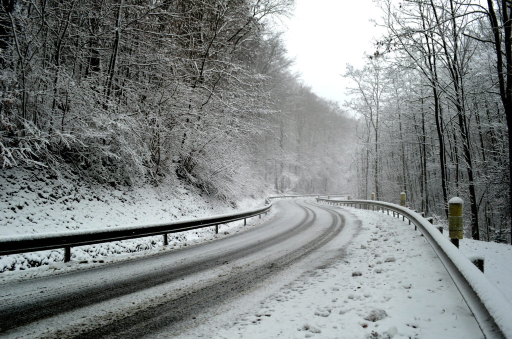
The Alabama Department of Transportation (ALDOT) has crews responding across all areas of the state experiencing winter weather today due to Winter Storm Benji. Roadway and weather conditions will be monitored as long as necessary, with road and bridge treatment ongoing in affected areas. ALDOT crews will be actively working to keep State, U.S. and Interstate highways open. Currently, all highways remain open, but the public is urged to check www.algotraffic.com for alerts and road closure information, and to monitor their local news media for information about road conditions. Travel conditions could be considered hazardous in areas where there is any precipitation, whether it is snow, rain or a wintry mix. ALDOT urges everyone to avoid travel where adverse conditions are present until roadway and weather conditions improve. Reports from the National Weather Service mid-morning Friday said all city roads were closed in Talladega, and some streets in Anniston were becoming impassable, with multiple wrecks reported. For additional information, visit dot.state.al.us.
Alabama cities break records for Christmas Day temperatures

Forecasters say that several Alabama cities set record high temperatures on Christmas Day. Al.com reports that one of the state’s warmest readings was in Montgomery, where it was 82 degrees on Sunday, breaking the record of 81 from 1987. Birmingham hit 78 degrees Christmas Day, breaking the previous record of 77 set last year. Tuscaloosa tied its record high for the date of 80 degrees. The National Weather Service reports that Mobile’s high of 80 degrees on Christmas Day broke the record of 79, which was set in 2015. Republished with permission of the Associated Press.
Rain brings short-term relief, didn’t end Alabama drought
Meteorologists say storms that dumped as much as 5 inches of rain on Alabama didn’t end the drought. The heaviest rains fell near the middle of the state, accumulating about 5 inches. Precipitation totals of more than 2 inches were common throughout central Alabama late Monday and early Tuesday. Although rainfall amounts varied across the counties of the state, it is expected to give only short-term relief to the wildfires burning recently in Alabama. “The precipitation we received should temporarily help us with the wildfire situation and hopefully more rain is on the way,” stated Interim State Forester Gary Cole of the Alabama Forestry Commission (AFC). “This reprieve will allow firefighters some much needed rest, as well as an opportunity to perform equipment repairs and maintenance.” Monday was a historic day in the number of active wildfires burning in Alabama for one day: 108 fires destroyed 2,742 acres across the state. Cole continued, “Most of us veteran firefighters here don’t remember that many fires in one day. Not only was the number of wildfires higher, but they were also larger in size.” “I cannot thank the men and women with the Alabama Forestry Commission enough for their dedication, tireless efforts and countless hours spent battling fires across the state,” said Bentley. “Because of their efforts, wildfires in Alabama have been prevented from doing extensive damage. Their commitment to protecting life, property and wildlife does not go unnoticed.” Many areas are more than a foot below normal rainfall, and as such Governor Robert Bentley‘s statewide ‘No Burn’ Order —prohibiting all outdoor or open burning, making it illegal for any person to set fire to any forest, grass, woods, wildlands or marshes; building a campfire or bonfire; or burn trash or debris — remains in effect. Additional rain this week may allow the situation to be re-assessed later this week.
As Democratic convention nears, excessive heat settles in
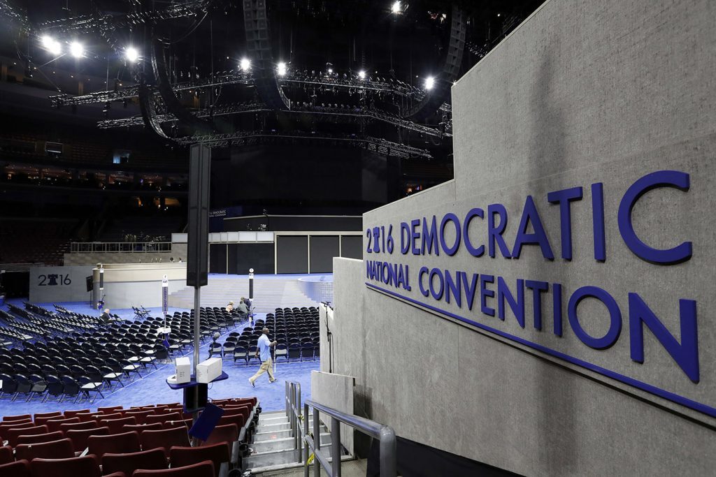
As thousands of delegates arrive in Philadelphia for the Democratic National Convention, it’s not just politics they have to contend with — it’s also the hot and sticky weather. The heat wave that descended on the city is expected show no mercy on Sunday with temperatures around 96 degrees. It could peak on Monday, the convention’s first day, with temperatures possibly hitting 100 degrees, said Mitchell Gaines, a meteorologist with the National Weather Service in Mount Holly, New Jersey. Many parts of the United States are experiencing higher than normal temperatures — like most of the Midwest — but the Philadelphia area is slated to be the hardest hit in the Northeast. Other parts of the region, including New York City, are in heat advisories. And the higher temperatures have brought powerful thunderstorms to some New England states, rain knocking out power to tens of thousands of residents. In Arizona, where temperatures hit 112 on Friday, a 12-year-old boy died after becoming ill after a hike. Along with the considerable amount of humidity, the heat index in the Philadelphia area could be pushed as high as 108 on Monday, Gaines said. Highs in the mid- to upper-90s are expected each day through Wednesday. “The multiple days of excessive heat will greatly affect those who are attending outdoor activities, especially events with large groups of people that are gathering in the direct sun,” the weather service said. Officials warned that in urbanized areas such as Center City Philadelphia, even nighttime temperatures may not drop below 80, especially Monday night. There also is the possibility of thunderstorms, such as the brief one which lashed Philadelphia during the late afternoon and evening on Saturday To protect thousands of demonstrators expected during the July 25 to July 28 DNC, Philadelphia officials said two medic tents and two “misting” tents would be set up and water would be distributed. Medics also would be assigned to take part in marches. Workers preparing for the convention and others in downtown Philadelphia on Saturday afternoon were trying to keep cool. Will Adams, 69, of Pennsauken, New Jersey, stood next to a gigantic air conditioner under tents being erected outside the Comcast Center for a DNC event. He and the crew were putting up speakers and television screens as security fences were going up outside. He couldn’t help but think wistfully about the mild weather during similar preparations for the papal visit last September. “That was good weather then,” he said. Chris O’Brien, 36, of Flourtown, Pennsylvania, stood by a spray park — a public water play site — rocking his 2-month-old, Maeve, who was sleeping under the shade of a towel. He was waiting for the rest of his family while he watched former Philadelphia mayor Michael Nutter a few yards away, in a suit, shooting a CNN panel broadcast. O’Brien said he and his family planned to spend a lot of time in air conditioning for the next few days. “Libraries, the mall … and we were thinking about going to the Please Touch Museum or the Franklin Institute. Whatever there is to do inside, we’re doing it,” he said. Avere Scurry, 21, sitting behind the cash register at a pop-up beer garden across near the Philadelphia Museum of Art and its famed “Rocky” steps, said staff members were taking precautions in the heat. “It’s not easy, but we have umbrellas so that helps. We have water. There’s a trailer over there that’s air conditioned … so every couple of minutes we’ll rotate and we’ll sit in the air,” Scurry said. Republished with permission of the Associated Press.
State sales tax holiday exempts weather preparedness items
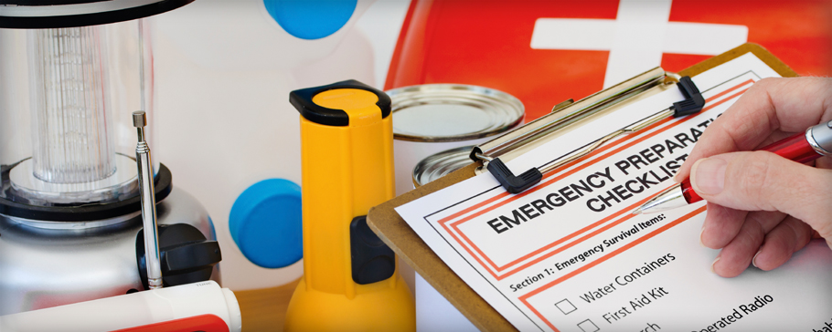
In the wake of tornado warnings and watches that have flashed across the state map over the past few weeks, Alabamians in several municipalities will have a little financial help this weekend readying for future weather emergencies. Alabama’s fifth severe weather preparedness sales tax holiday kicked off early Friday and will continue through Sunday, ending at midnight. The holiday exempts state sales tax and local sales tax at businesses in participating municipalities on certain severe weather preparedness supplies. Gov. Robert Bentley declared a state of emergency in Alabama on Tuesday when five confirmed tornadoes occurred in Alabama. “State officials purposely designed Alabama’s weather preparedness tax holiday, which always falls on the last full weekend of February, to occur before the height of both tornado and hurricane seasons,” said Nancy King Dennis, director of public relations for the Alabama Retail Association. While all state tax is exempt, individual municipalities and counties have the option to waive local tax. The tax-exempt status applies to a specified list of supplies costing less than $60 that would be helpful for a home or business to have on hand during a weather emergency, including batteries, tarps, weather radios and more. Also, any portable generator or power cords that cost $1,000 or less in a single purchase are included. “The goal of Alabama’s fifth annual severe weather preparedness sales tax holiday is to encourage consumers to stock up on emergency supplies before the storm hits,” Dennis said. “Consumers tend to wait until after the fact to get the supplies needed, which can put them in harm’s way if they venture out in hazardous conditions.” Dennis added that the holiday encourages consumers to build emergency kits for homes, vehicles and businesses in advance. “The sales tax holiday provides a good time to do that and save money,” she said. In Auburn, Cindy Salter, manager of Ace Hardware on East University Drive, said that she does notice that certain items typically get more attention on the holiday weekend. “We don’t see a higher traffic flow of customers, but we do have a higher traffic flow of particular products,” she said, adding that batteries, flashlights, tarps and ropes tend to be popular. Salter said she thinks the holiday is a good incentive to check on one’s emergency preparedness items. “Because number one, it’s tax-free,” she said. “That’s always a big help. And also because it makes them aware of the necessities that they need during severe weather, and it gives them an opportunity to stock up on them.” In Opelika, Dozier Smith T, owner of Winston Smith T Building Supply, said people often seem to wait until after there is a weather emergency to act. “It’s always good to be prepared,” Smith T said. “A lot of times, you don’t know when an emergency’s going to happen, there’s a run on things, and you might end up not having it.” Republished with permission of the Associated Press.
Daniel Sutter: The U.S. hurricane drought
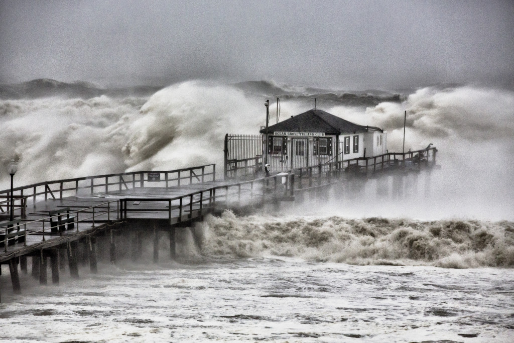
Last weekend marked ten years since Hurricane Wilma struck Florida as a Category 3 storm on the Saffir-Simpson hurricane intensity scale. Wilma was the last major hurricane (categories 3, 4 and 5) to strike the U.S. Ten years is the longest span between major hurricane landfalls since 1851, exceeding the longest prior drought (1860-1869) by over a year. The hurricane future appeared very different ten years ago. Global warming was allegedly making hurricanes more frequent and devastating, and hurricanes were going to get worse. The busy 2004 and 2005 seasons certainly made hurricanes seem more frequent. The 2005 Atlantic season featured 28 named storms (we ran through our alphabet and had to use Greek letters as names) and 15 hurricanes, both records. Katrina devastated New Orleans and the Mississippi coast that year. Seven major and thirteen total hurricanes struck the U.S. in 2004-05. Hurricanes also seemed more devastating than ever. Katrina caused $100 billion in damage (adjusted for inflation) and the highest U.S. death toll since 1928. At the end of 2005, 6 of the 8 costliest hurricanes on record had occurred in the previous two years. This part of the tale, however, was misleading. Economists know to adjust historical dollar figures for inflation. But adjusting for inflation does not make damage from past and present hurricanes fully comparable. Increases in population and wealth mean that hurricanes have a lot more property to destroy now. Damage normalizations assuming that damage will increase proportionally with population and wealth per person provide more accurate comparisons. Normalizations provide an educated guess about the damage we could expect if past hurricanes occurred today. Normalization dramatically increases the damage measured in past hurricanes. Consider the “Great Miami Hurricane” of 1926. Miami Beach has grown from a population of 644 in 1920 to 90,000 today, and is home to some very expensive real estate. Normalized damage from the Great Miami Hurricane exceeds $200 billion, or more than double Katrina’s total. Once normalized, hurricane damage has not been increasing over time. Increases in population and property at risk, what researchers call societal vulnerability, explain rising damages. Societal vulnerability has increased significantly. The population of Atlantic and Gulf coast counties, for example, has increased from under 6 million in 1900 to almost 38 million in 2010. The value of insured property at risk from hurricanes now exceeds $10 trillion. Societal vulnerability is not necessarily bad. The U.S. population has more than quadrupled since 1900, and people must live somewhere. Areas safe from hurricanes can face tornado, earthquake, or tsunami risk. Furthermore, Americans value living and vacationing near the ocean, while many industries must locate near the coast. We can now afford what previously would have been catastrophic losses. Coastal development is worthwhile as long as the value created exceeds the potential hurricane damage. The extra costs will be reflected in prices of rental or vacation properties, or goods like gasoline or chemicals. Several government policies, however, subsidize hurricane losses and thus encourage development when the value created does not exceed the extra costs. The two most prominent policies are state homeowners insurance regulation and the National Flood Insurance Program. Both of these policies push some of the costs of insurance against hurricanes on to other Americans. Does the U.S. hurricane drought prove that global warming is not occurring? Not necessarily. This past decade has witnessed some active Atlantic hurricane seasons, and Mexico has been hit be two Category 5 hurricanes, including Patricia this past weekend. The drought might just be luck. And yet the hurricane drought, combined with the more than decade-long warming pause in satellite-measured temperature records, like the one maintained at the University of Alabama-Huntsville, should make us rethink global warming policy. The Clean Power Plan, for instance, will cost us hundreds of billions of dollars, and yield few benefits if warming is not as bad as climate models forecast. On the other hand, the U.S. will be hit by major hurricanes in the future regardless of whether the climate warms. Eliminating inefficient government policies will reduce the cost of hurricanes, and the damage avoided will escalate if global warming strengthens future hurricanes. Daniel Sutter is the Charles G. Koch Professor of Economics with the Manuel H. Johnson Center for Political Economy at Troy University and host of Econversations on TrojanVision.
Daniel Sutter: I prefer studying tornadoes at a distance
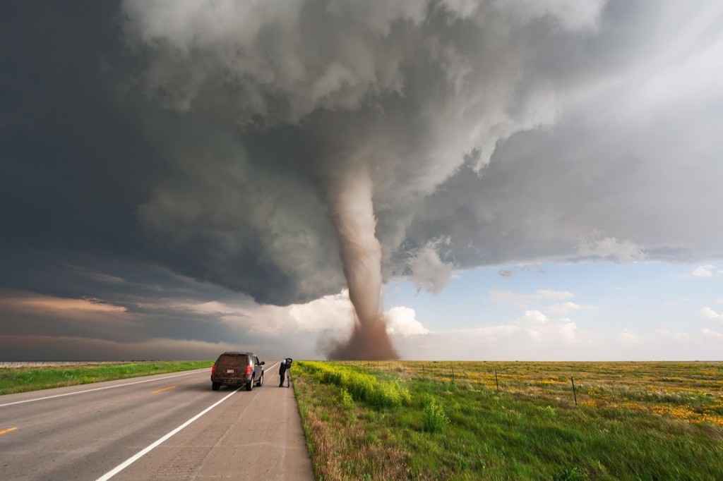
I have conducted research on tornadoes for fifteen years. As an economist, I do not study the storms themselves, but rather the impacts of tornadoes on society. I mainly search for patterns in casualties or damages, which can be done safely away from the tornadoes. I have done some field research, and never wish for the opportunity to do field work in my neighborhood. Last week’s tornado in Troy occurred without warning, meaning that the National Weather Service (NWS) did not issue a warning until after touch down. Is it still possible today for tornadoes to occur without warning? Yes, and nationally about 30 percent of tornadoes are unwarned. NWS forecasters face significant challenges in issuing warnings, which we must recognize to help limit tornado impacts. Tornadoes form out of thunderstorms. If we think of thunderstorms as parents of tornadoes, several types of parents exist. Parent types interact with the technology and tools available to NWS forecasters. Last week’s tornado was a spin up that occurs in the bottom portion of the parent thunderstorm, perhaps the lowest 10,000 feet; thunderstorm clouds can rise to 40,000 feet or higher. In classic tornado conditions, rotation occurs much higher up in the thunderstorm. Doppler weather radars cannot see the lowest part of thunderstorms because of the curvature of the Earth. The phrase “flying under the radar” refers to a plane flying low to avoid detection by radar. Spin up tornadoes fly below the radar too. Many thunderstorms will look to forecasters just like last Thursday’s storm. Warning for every such thunderstorm would likely produce a dozen or more false alarms for every tornado. To appreciate why, summer thunderstorms occur almost daily in Alabama, while summer tornadoes are quite rare. Last week’s tornado was the first in Pike County not associated with a tropical system since 1950. The NWS could prevent unwarned tornadoes by warning for every thunderstorm. Yet this would raise the false alarm ratio dramatically, and already three out of every four tornado warnings are false alarms. My research has documented the cost of false alarms. People and businesses respond to tornado warnings. Walmart, for instance, monitors severe weather and orders stores into lockdown during warnings. Tornado warnings disrupt our lives – shopping, dining, television, homework – quite extensively. My research with Somer Erickson found that over 200 million person hours were spent under warnings nationally each year. The value of time under warnings exceeded other types of tornado impacts, including the property damage or value of deaths or injuries. Increasing false alarms would also prove deadly. We are all remember the story of the boy who cried wolf too often, and so too many false alarms will lead people to ignore warnings. Kevin Simmons and I found in a study of twenty years of tornadoes and warnings that a higher false alarm ratio increases the lethality of tornadoes. Furthermore, Kevin and I showed that aggressively warning to prevent unwarned tornadoes would result in more deaths through false alarms than saved through warnings. Last week’s tornado was rated EF-1 on the Enhanced Fujita Scale, and almost all spin up tornadoes are weak (rated EF-0 or EF-1). Over 75% of all U.S. tornadoes are weak, and yet account for just 5% of fatalities, 9% of injuries, and 10% of property damage. Issuing lots of warnings for potential weak tornadoes may lead people to ignore a warning for a far more dangerous tornado. And the precautions we should take during thunderstorms offer pretty effective protection against unwarned weak tornadoes: stay inside and away from windows. Falling trees represent a danger in thunderstorms and weak tornadoes, so stay out of rooms with big trees outside. It would be nice if the NWS could warn for all tornadoes and never issue a false alarm. But Mother Nature does not allow this. Ignoring tradeoffs leads us to make bad decisions, a familiar theme in this column. The existence of this tornado warning tradeoff is just one of the many ways economists contribute to discussions of severe weather. Daniel Sutter is the Charles G. Koch Professor of Economics with the Manuel H. Johnson Center for Political Economy at Troy University and host of Econversations on TrojanVision.

