Oil spill releases over one million gallons into Gulf of Mexico

An oil spill has released over a million gallons of oil into the Gulf of Mexico. The U.S. Coast Guard reports that the leak was first reported to them on Friday. The Coast Guard reports that the leak appears to be near the Main Pass Oil Gathering (MPOG) company’s pipeline system, located around Plaquemines Parish, La., southeast of New Orleans. We do not know when the leak began, but it was initially reported to the National Oceanic and Atmospheric Administration (NOAA) Thursday morning around 9:10 a.m. There is a three- to four-mile-wide slick, but the search for the specific location of the leak is still ongoing. “Remotely operated vehicles, deployed Friday morning, continue to survey the pipeline with no findings of a source area at this time,” the Coast Guard reported Tuesday. This is not the 2010 Deepwater Horizon, but this is one of the biggest oil spills in U.S. waters, with initial assessments estimating that it is at least 1.1 million gallons. The Deepwater Horizon disaster killed 11 oil workers, released millions of gallons of oil into the Gulf, took five months to shut off the flow of oil, and killed up to 105,400 sea birds. It is too early in this process to estimate how this spill will impact marine life, the fishing industry, or the Gulf Coast. Oil drilling in the Gulf region has become increasingly controversial, with environmentalists claiming that the continual threat of ecological catastrophe is far greater than the economic rewards from drilling. Oil workers who make their livelihoods from working on the oil rigs, exploring for new oil, and refining the oil and natural gas and Gulf coast states who depend on the revenue from offshore leasing disagree. In January 2021, President Joe Biden signed an executive order that would freeze all new oil and gas leasing on public lands and waters. After a series of unfavorable court rulings, the administration ended the pause and resumed leasing. The Inflation Reduction Act in 2022 requires the administration to hold a series of lease sales in the Gulf, originally scheduled for September but currently pushed back to December. The administration also auctioned off 1.6 million acres for leasing in March. In August, the state of Louisiana joined Chevron and the American Petroleum Institute in suing the administration for shrinking the acreage being auctioned off. The administration claimed that it did so to protect the endangered Rice’s whale. Last week, a federal court rejected the administration’s arguments. The Coast Guard, MPOG, and the Louisiana Oil Spill Coordinator’s office have formed a Unified Command team to investigate the source of the spill. The pipeline was shut down on Thursday when MPOG realized there was a problem with the 67-mile pipeline. The exact source of the leak remains unknown. Alabama Today is continuing to monitor this situation> To connect with the author of this story or to comment, email brandonmreporter@gmail.com.
Dan Sutter: Of wind and whales

Whales have been dying off the East Coast of the United States near where offshore wind turbines are being or about to be built. The North Atlantic Right Whale faces extinction, with only perhaps 340 left in the wild. Should endangered species take precedence over energy production? NOAA’s National Marine Fisheries Service denies a link between whale deaths and wind turbines. However, a recent investigation by the independent news organization Public identifies correlation between whale deaths and boat traffic and sonar activity associated with construction. Whale deaths have increased sharply since 2017, when turbine construction began. This constitutes correlation, but correlation does not prove causality. Sonar and construction may be pushing whales into high-traffic boat lanes, producing more collisions with boats. NOAA acknowledges trauma from boats in many whale deaths. Marine biology is not economics, so I will not take a definitive position on the causation question. For full disclosure, I have previously received funding from NOAA for my research, so I may have a bias here. I believe that additional research is warranted. I instead wish to consider whether whales should trump energy development. We might think that 1973’s Endangered Species Act (ESA) settled this question and should protect the Right Whales. The ESA seemingly unambiguously prohibits the taking of endangered and threatened species. But this protection is not ironclad. The Federal government must declare critical habitat for a species and decide whether actions disturb habitat. Consequently, species protection depends on bureaucrats. Construction projects sometimes proceed with modifications. The NMFS has set sound limits for sonar, which the Public’s reporting contends are being violated. Damage to the environment or harm to species is almost always a by-product of productive activity (including hunting as food production). We live in a world of scarcity, meaning that we want more goods and services than can be produced. Market prices for scarce resources make it costly to burn a rainforest or kill whales just for fun. Habitat loss is a major threat for many endangered species. People use land for agriculture, logging, or to build beach resorts, depriving species of breeding or hunting grounds. These impacts are unintended and sometimes initially unrecognized. Let’s focus now on offshore wind and Right Whales. I hold human flourishing as my standard of value. Consequently, I believe the ESA is misguided. Humans may impact nature to survive and thrive; if this happens to drive species to extinction, that is acceptable. We can and do choose to impose on ourselves to improve the lives of animals, but these choices should entirely reflect our preferences. There may be little consistency in our choices of plants and animals to protect. The bald eagle somehow became a national symbol, and Americans chose to protect this species. What we label animal rights are ultimately human sensibilities. I would not put whales ahead of energy. But human survival and thriving does not require offshore wind; climate change does not pose an existential threat. If you doubt this, read the IPCC reports summarizing the academic literature. Humanity could adapt to an additional two degrees Celsius warming. Humans at the subsistence level survived much greater climate changes during and after the last glacial period. Given that fossil fuels do not threaten extinction, I agree with Alex Epstein that we should ensure human flourishing in the manner least disruptive to the environment. Wind and solar have enormous environmental footprints. Both require enormous land areas, kill thousands of birds and bats annually, use gigantic quantities of rare earth metals, and result in huge quantities of toxic waste. The key to meeting the energy needs for human flourishing with minimal environmental disruption is energy density, as Mr. Epstein argues. Wind and solar are very low density compared to fossil fuels, with nuclear power even better. The energy transition is largely a plan to enrich opportunistic profiteers driven by fear of a climate apocalypse. We should not kill whales merely to enrich politically connected “clean” energy companies when lower-cost and lower-impact energy sources can support human flourishing. Daniel Sutter is the Charles G. Koch Professor of Economics with the Manuel H. Johnson Center for Political Economy at Troy University and host of Econversations on TrojanVision. The opinions expressed in this column are the author’s and do not necessarily reflect the views of Troy University.
NOAA Fisheries releases first ever National Seafood Strategy
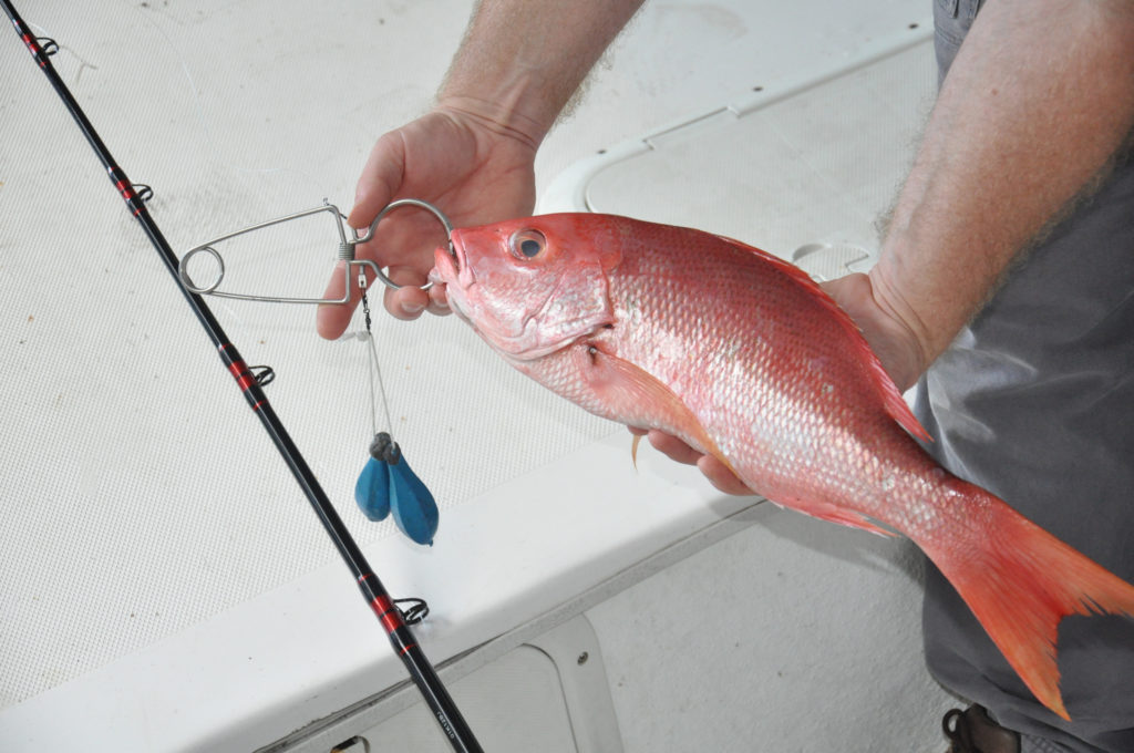
On Wednesday, the National Oceanic Atmospheric Administration Fisheries division released the first-ever National Seafood Strategy. The strategy highlights the vital services the federal government provides to support the seafood sector and outlines ways that NOAA can enhance its resilience in the face of climate change and other stressors. NOAA Fisheries has released the National Seafood Strategy after several rounds of stakeholder input and a public comment period earlier this year. NOAA says that the strategy underscores NOAA’s strong commitment to seafood sector resilience and aligns with the Biden Administration’s goals for economic recovery, environmental sustainability, and climate resilience. The White House Conference on Hunger, Nutrition, and Health highlighted the need for increased seafood consumption in the United States, which NOAA believes this strategy addresses. The U.S. seafood industry has to deal with climate change, new technologies, other ocean uses, significant labor shortages, and aging infrastructure. NOAA says that the National Seafood Strategy outlines NOAA Fisheries’ direction for supporting a thriving domestic U.S. seafood economy and describes the government’s approach to enhancing the resilience of the seafood sector in the face of climate change and other stressors. The U.S. seafood sector contributes to the nation’s climate-ready food production and to meeting critical domestic nutritional needs; while supporting jobs, the economy, and the competitiveness of the U.S. seafood sector. NOAA said that it plans to achieve its vision by focusing on four goals: 1) Maintain or increase sustainable U.S. wild capture production 2) Increase sustainable U.S. aquaculture production 3) Foster access to domestic and global markets for the U.S. seafood industry 4) Strengthen the entire U.S. seafood sector NOAA said that public comments and stakeholder input were integral to finalizing the strategy and helping guide the direction of our work to support the seafood sector. “We received more than 150 separate comments, about a quarter of which were from organizations, including fishing, aquaculture, and seafood associations, non-profits, NGOs, aquariums, and state agencies,” NOAA stated in the release. “In addition, five regional fishery management councils provided comment letters. Many of the comments were used to strengthen and improve the strategy, particularly to clarify phrases or context, such as adding descriptions of other agency strategies and policies. One significant change from the draft is the addition of an Equity and Environmental Justice objective under Goal 4.” NOAA said that the new National Seafood Strategy will reinforce NOAA Fisheries’ critical science and management support to the seafood sector. NOAA said the “stakeholders recognize that the science conducted by the agency to support management of wild capture fisheries and seafood farming is essential for the well-being of the U.S. seafood sector. The industry needs NOAA Fisheries and other federal agencies to provide more support for and attention to adaptation to climate change, changing markets, and new ocean uses; new domestic sources of seafood supply (wild capture and aquaculture); fair trade; workforce development; and recapitalizing and modernizing seafood infrastructure.” Over the past decades, one area of contention between NOAA and state of Alabama officials has been the number of red snapper in the Gulf of Mexico and the limits NOAA places on private anglers and commercial fishermen. The state believes NOAA has, in the past, significantly undercounted the red snapper population and the fishery’s health. To connect with the author of this story or to comment, email brandonmreporter@gmail.com.
NOAA releases study on protecting endangered species while building offshore wind developments in Gulf of Mexico
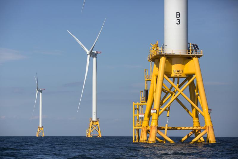
The Biden administration is looking at offshore wind farms in the Gulf of Mexico to reduce American dependence on fossil fuels. The National Oceanic and Atmospheric Administration’s Fisheries Division wants to be able to do this without negatively impacting the endangered marine species which it manages. On Monday, a new peer-reviewed study, “Protected species considerations for ocean planning: A case study for offshore wind energy development in the U.S. Gulf of Mexico,” was published in Marine and Coastal Fisheries. The study details NOAA’s efforts to accomplish both goals. It is part of a special theme issue of the online journal entitled “Offshore Wind Interactions with Fish and Fisheries.” The issue will feature several more NOAA Fisheries-authored papers on offshore wind energy topics as they are published. This paper details NOAA Fisheries’ development of scoring methods to assess potential protected species conflicts with offshore wind. NOAA National Centers for Coastal Ocean Science and the Bureau of Ocean Energy Management developed spatial models used in the study. The generalized scoring approach considers species conservation status and demographic information. In the spatial models, a score of one reflects an area with low siting conflicts. A score of zero reflects an area with high siting conflicts. The paper evaluated the spatial distributions for 23 species listed under the U.S. Endangered Species Act and Marine Mammal Protection Act, identifying high-use and low-use areas for each species and scoring these areas from 0.1 to 0.9. A score of 0.1 reflected a high-use area for an endangered species with a small and declining population; a score of 0.9 reflected a low-use area for a non-strategic MMPA stock. NOAA said that the researchers combined these layers spatially and integrated them into the siting model. The NOAA Fisheries combined layer informed relative risk for siting wind energy activities in a given area while accounting for the overlap of different protected species. This integration resulted in a 70 percent reduction in potential siting conflicts with protected species within the final selected wind energy area. These estimates are based on current and expected species occurrence and distribution patterns. This work represented a successful collaboration between NOAA Fisheries, NOAA National Centers for Coastal Ocean Science, and the Bureau of Ocean Energy Management. The goal was to proactively minimize potential interactions between renewable energy development and protected species. The approach is straightforward, repeatable, and transferable to other regions, to other sensitive or protected species, and to other marine spatial planning applications. However, these are static models. NOAA Fisheries needs continuous monitoring data to ensure models can be adapted to shifting species distributions due to climate change or ecosystem perturbations. NOAA hopes that this collaborative work will provide a foundation for early engagement and strategic marine spatial planning for offshore wind energy to reduce potential adverse effects on protected species. It also provides a reference for work conducted to inform this process and a template for other regions as these efforts expand. Last year the Biden Administration announced that the first two of its planned wind farms will be off the coast of Galveston, Texas, and Lake Charles, Louisiana. The Galveston wind farm will be developed 24 nautical miles off the coast of Galveston, covering a total of 546,645 acres and will power 2.3 million homes, according to the U.S. Interior Department’s Bureau of Ocean Energy Management. The Louisiana wind farm will be about 56 nautical miles off the coast of Lake Charles, Louisiana, and will cover 188,023 acres with the potential to power 799,000 homes. The Biden Administration has not yet announced its plans for the Alabama Gulf Coast. There are concerns that wind farms in the Gulf of Mexico will be cost-prohibitive and that hurricanes will do substantial damage to offshore wind farms making recovery from future hurricanes even more protracted. This is on top of the environmental concerns that the NOAA study seeks to address. There is also a significant cost element to this. One researcher estimates that it would cost four times as much money to produce electricity from Gulf of Mexico wind farms as it does to produce it from natural gas in Louisiana now. Producing more green energy will almost certainly result in substantially higher electric bills for American consumers. There are currently only two operational offshore wind farms in the U.S. – one off of the coast of Rhode Island and the other off of the coast of Virginia. To connect with the author of this story or to comment, email brandonmreporter@gmail.com.
Red snapper season continues through July 4
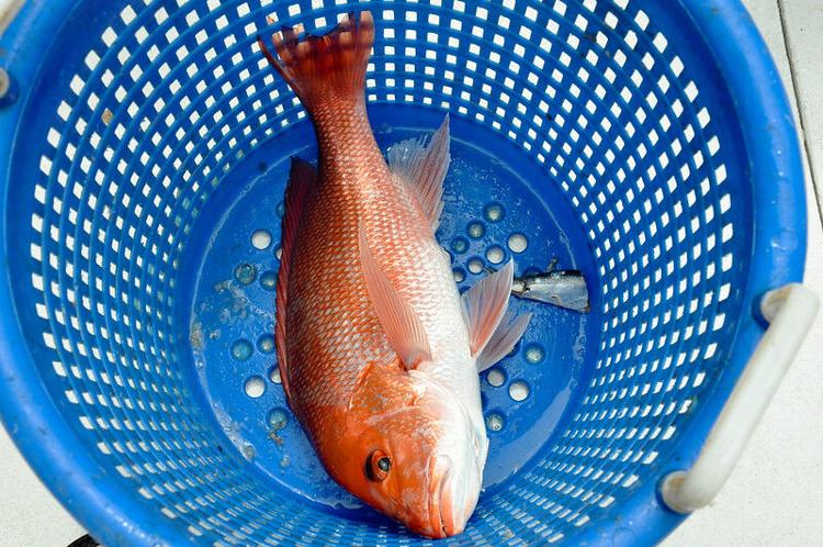
On Thursday, the Marine Resources Division (MRD) of the Alabama Department of Conservation and Natural Resources (ADCNR) reminded Alabamians that state waters and federal waters will be open to private and state-licensed charter vessel anglers for red snapper harvest on Tuesday, July 4, 2023. Scott Bannon is the Director of the Marine Resources Division. “The Fourth of July is traditionally a day when families spend time together on the water,” said MRD Director. “We are thankful to be in a position to provide the opportunity for people to catch red snapper this Independence Day. A closing date for the season will be announced when the 2023 quota is anticipated to be met. Anglers are encouraged to continue reporting their harvest through Snapper Check and participate in the dockside surveys conducted by MRD staff. Accurate reporting helps us best manage Alabama’s red snapper season.” Every fisherman is required to report any red snapper to ADCNR through the Snapper Check system. This includes shore, private vessels, and state charter angler landings. Red snapper landings updates are posted weekly during the season on ADCNR’s Red snapper page. As of June 26, 2023, anglers have already harvested 361,314 pounds of the state’s 2023 federal quota of 591,185 pounds. Fishermen have less than 130,000 pounds to harvest before government authorities will have to shut red snapper fishing down for the remainder of the year. Alabama anglers have harvested 130,000 pounds of red snapper in just the last 17 days – well ahead of last year’s pace, where the quota was never reached. If this is a big fishing week, red snapper harvesting could likely be shut down before the middle of July. The Alabama private angler quota for 2023 was set by the Biden Administration’s National Oceanic and Atmospheric Administration (NOAA) Fisheries division. The dramatically lower red snapper quota is a result of changes concerning the difference between state and federal harvest landing systems. The Marine Resources Division hopes that there will be an increase to Alabama’s 2024 red snapper quota due to an increase in the annual catch limit for Gulf red snapper that is currently in the rulemaking process at NOAA Fisheries. Chris Blankenship is the Commissioner of ADCNR. “Even with the changes to Alabama’s quota this year, we are having a great red snapper season,” said Commissioner Blankenship. “Adding the Fourth of July holiday for red snapper fishing will be good for families and friends celebrating our freedoms on the water that day in coastal Alabama.” Anglers are reminded that the daily bag limit is two red snapper per person, per day, with a minimum size limit of 16 inches in total length. To take any fish beyond the two-fish limit or any red snapper smaller than 16 inches is strictly illegal. To lawfully fish for red snapper – or any other saltwater fish – you must have a valid Alabama Saltwater Fishing License. Anglers have numerous fish that they may legally harvest in state and federal waters if the red snapper limit is reached. NOAA is holding a meeting of the Gulf of Mexico Fishery Management Council on August 14 – 17 in Austin, Texas. The Council will be in Gulf State Park in Gulf Shores, Alabama, on April 8 – 11. To connect with the author of this story or to comment, email brandonmreporter@gmail.com.
Red Snapper season to end on December 31
On Wednesday, the Alabama Department of Conservation and Natural Resources (ADCNR) Marine Resources Division (MRD) announced that Alabama’s Red Snapper private angler season will close at midnight on December 31. MRD reports that Alabama anglers caught far fewer fish than the federal government allocates to Alabama fishermen. Alabama’s 2022 federal allocation of red snapper was 1.12 million pounds. Anglers have to this point, actually harvested less than 500,000 pounds during the 128-day season. “Every year, a variety of factors impact the effort in this fishery,” said Scott Bannon, MRD Director. “Those factors influence the number of days Alabama is open to fishing for red snapper. Good weather throughout the summer and fall provided anglers with more opportunities to participate this year. We also want to thank anglers for reporting their red snapper harvests through Snapper Check. It is an important tool in providing increased access to this fishery.” The size of the state’s red snapper allocation and the length of the season has been a point of contention between the state and federal regulators with the National Oceanic and Atmospheric Administration (NOAA) for years. MRD says that it will announce the 2023 season dates in the coming months once NOAA Fisheries finalize the 2023 quota. “It has been a good, long red snapper season in Alabama this year,” said Chris Blankenship, ADCNR Commissioner. “Under Alabama state management, we were able to provide maximum access in 2022. This is the sixth successful red snapper season under state management. It was good to see anglers reeling in red snapper throughout the summer and fall. ADCNR will continue fighting to ensure our citizens and visitors have access to the incredible red snapper fishery off the coast of Alabama.” NOAA has announced that private angler red snapper catch limits for red snapper will increase in 2023 as the numbers of red snapper have increased in the federal government’s most recent assessments. MRD has also announced that the state will close all Alabama waters to oyster harvesting on Friday at 2:00 p.m. To connect with the author of this story, or to comment, email brandonmreporter@gmail.com.
Georgia reports number of female breeding age North Atlantic right whales down to just 72
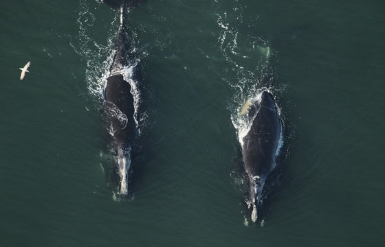
The Georgia Department of Natural Resources (GDNR) reported in an emailed statement that there are fewer North Atlantic right whale females of breeding age and fewer whales overall. GDNR reports that survey flights are underway to document North Atlantic right whales began during November along the Atlantic Coast as the right whales have begun their calving season. The species calves off of the waters of the Georgia and North Florida coasts – their only known remaining calving grounds left in the world. New studies have detailed the dire state of the large marine mammals. The total population was estimated at just 340 individual whales in 2021, which is ten fewer than in 2020. That was followed by a new study showing that the population of breeding-age females has declined from 2014-2018. Researchers say there are only about 72 females left of breeding age and that fewer females are transitioning from pre-breeders to mothers. According to the finding, the right whales “can’t calve their way out of this problem,” said Clay George, a senior wildlife biologist who leads DNR’s marine mammal work. “The whales need a good calving year, but more importantly, we need to stop human mortality” from commercial fishing gear entanglement and vessel strikes. GDNR is urging recreational boaters to please slow down and be aware of the risks of hitting a right whale. Three right whale calves have been killed in collision with boats that are less than 65 feet long since 2020. The U.S. National Oceanic and Atmospheric Administration (NOAA) is proposing lowering the speed limit for boats that are 35 to 64 feet long along the U.S. East Coast to 10 knots (11.5 miles per hour). The threshold is now 65 feet. That proposal has raised questions and opposition from boatowners. There is also opposition to have new ropeless tackle regulations for lobster and Jonah crab trap and pot fisheries in the Northeast. The recreational boating industry has objected to lowering the speed limit proposal. Boaters can get a whale app on their phones so that they will be aware when they are in waters where whales are present. When commercial hunting of the whales was banned in the 1930s, there were possibly less than 100 North Atlantic right whales left. The population had rebounded then, but the low number of breeding females, coupled with a shrinking population, concerns scientists. George said that the number of pre-breeding age females is holding steady at 70. “If some of those females start having calves, it could really help,” George said. There were also fewer whale deaths this spring and summer. No right whale carcasses were spotted in New England or Canada last spring or summer for the first time since 2013. “A lot’s being done to increase protections and awareness in the U.S. and Canada,” George said. “Hopefully, we’re starting to see the fruits of those efforts.” The life expectancy of right whales is not known, but it is at least 70 years and could be well over a hundred and fifty years based on research with bowhead whales. Because the animals are so large and so long-lived it takes many years for a calf to reach breeding age, and if the calf is killed in a boat wreck before breeding, then that individual does not live to replace itself. Right whales are so named because when a right whale is killed by a whaler, it does not sink, allowing whalers to collect the floating carcass. Thus it is considered the “right” whale to hunt. More modern whalers pumped compressed air into whale species that historically sank, allowing them to harvest those species as well since the number of right whales by then was far below the numbers to support whaling. The number of North Atlantic right whales has been in decline since 2010. High mortality from boat accidents with humans is a major factor in the decline. Whales were heavily harvested well into the twentieth century for their oil which was used for dozens of industrial purposes, but historically was used mostly for lighting lamps. American industrialist John D. Rockefeller probably did more than anyone to save the rapidly declining whale species around the world when his company, Standard Oil, began producing and marketing a much superior and more consistent lamp oil, kerosene – that he marketed as being “standard oil,” refined from petroleum rather than from whale blubber. Whale oil, prior to that point, was trading at an incredible $200 a barrel in today’s currency, meaning that whalers would go into even the most remote oceans pursuing the blubber that can be harvested for the oil. Despite this, whale oil continued to be used for some industrial purposes well into the twentieth century. Scientists are also concerned that global warming of the oceans could be negatively impacting the species that annually migrate from south Florida at about Cape Canaveral to well into the Arctic. North Atlantic right whales were listed as an endangered species in 1970. To connect with the author of this story, or to comment, email brandonmreporter@gmail.com.
Hurricane Ian moving through Central Florida as tropical storm
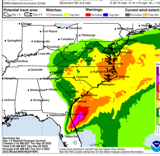
Hurricane Ian is producing “catastrophic flooding” across Central Florida as it churns slowly northward, the National Oceanic and Atmospheric Administration’s (NOAA) National Hurricane Center (NHC) reported at 7:00 a.m. CDT. Hurricane Ian came ashore along the southwestern Florida coast around 3:00 p.m. on Wednesday. The storm weakened overnight as it made its way overland and has been downgraded to a tropical storm. At 7:00 a.m. CDT, the center of Tropical Storm Ian was about 40 miles east of Orlando, Florida. Ian is moving toward the northeast near 8 mph. A turn toward the north-northeast is expected later today, followed by a turn toward the north and north-northwest with an increase in forward speed Friday and Friday night. On the forecast track, the center of Ian is expected to move off the east-central coast of Florida soon and then approach the coast of South Carolina on Friday. The center will move farther inland across the Carolinas Friday night and Saturday. Maximum sustained winds remain near 65 mph with higher gusts. Some re-intensification is forecast when it moves back across water, and Ian could be near hurricane strength when it approaches the coast of South Carolina on Friday. Weakening is expected Friday night and Saturday after Ian moves inland. Ian remains a powerful storm system with tropical-storm-force winds extending up to 415 miles from the center. Daytona Beach International Airport, far from the storm center, recently reported a sustained wind of 60 mph and a gust to 70 mph. The combination of storm surge and the tide will cause normally dry areas near the coast to be flooded by rising waters moving inland from the shoreline. Surge-related flooding depends on the relative timing of the surge and the tidal cycle and can vary significantly over short distances. Tropical storm conditions are occurring in parts of the warning area on the east and west coasts of Florida and should spread northward along Georgia, South Carolina, and North Carolina coasts today through Friday. Hurricane conditions are possible within the Hurricane Watch area in northeastern Florida, Georgia, and South Carolina through Friday. Widespread, life-threatening, catastrophic flash and urban flooding is occurring, with major to record flooding along rivers continuing across central Florida. Storm swells will increase along the coasts of Georgia, South Carolina, and North Carolina today. These swells are likely to cause life-threatening surf and dangerous rip currents on the Atlantic Coast. Governor Kay Ivey has pledged to provide support for the cleanup to Florida Gov. Ron DeSantis. Thousands of Floridians have evacuated to Alabama, and the state is opening shelters. Over a million homes in Florida are without power. Damage assessments will get underway later today when conditions improve. Residents and others are warned not to get out due to the risk of downed powerlines and still-rising floodwaters. To connect with the author of this story, or to comment, email brandonmreporter@gmail.com.
Hurricane Ian expected to do “catastrophic” damage to Florida coastal communities
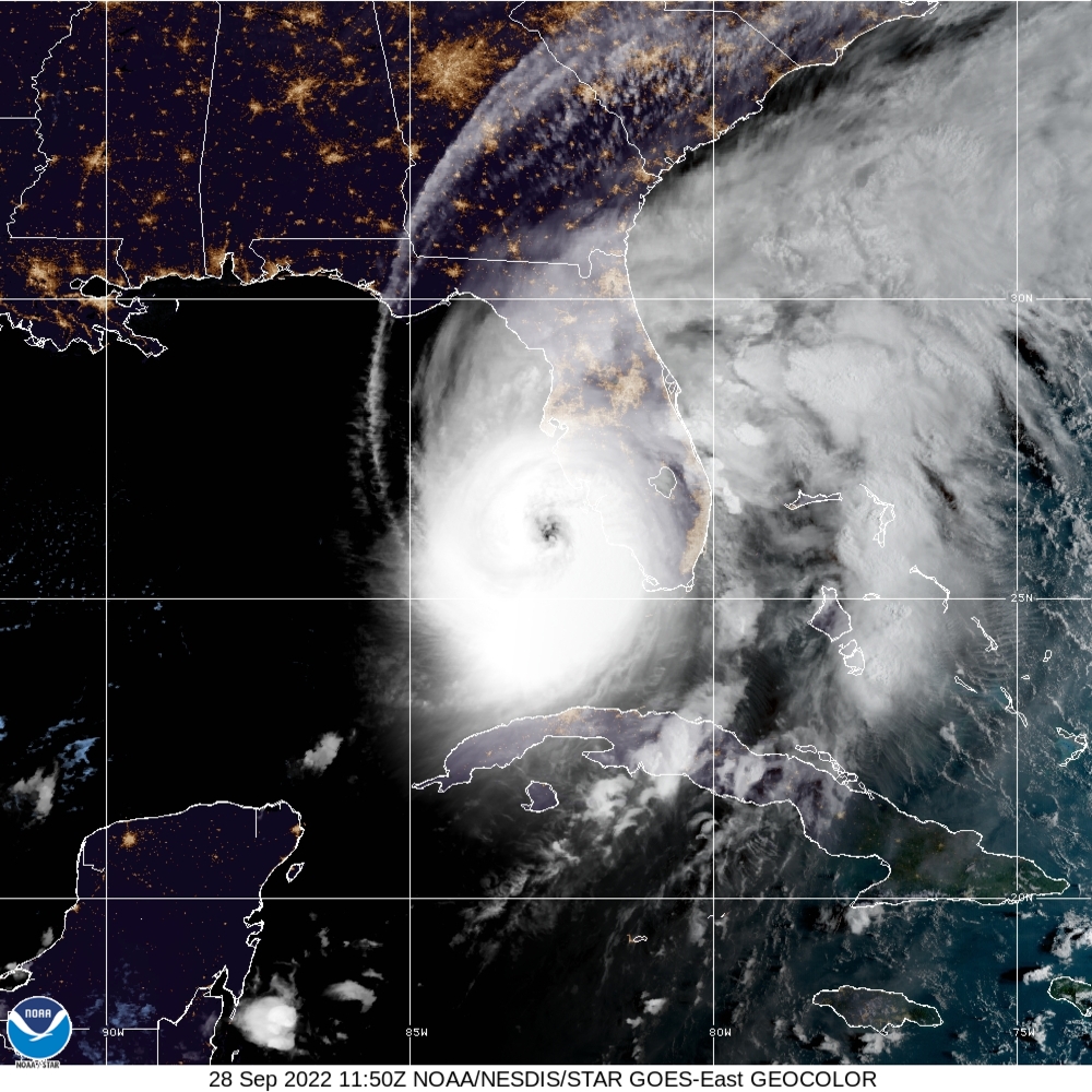
The National Oceanic and Atmospheric Administration’s (NOAA) National Hurricane Center predicts that Hurricane Ian will create catastrophic storm surge, winds, and flooding in the Florida Peninsula when it comes ashore later today. At 7:00 AM CDT, the NHC reported that the eye of Hurricane Ian was located by Air Force and NOAA Hurricane Hunter data plus Key West radar about 55 miles west of Naples, Florida. Ian is moving toward the north-northeast near 10 mph. This general motion with a reduction in forward speed is forecast today, followed by a turn toward the north on Thursday. On the forecast track, the center of Ian is expected to move onshore within the hurricane warning area later this morning or early afternoon. The center of Ian is forecast to move over central Florida tonight and Thursday morning and emerge over the western Atlantic by late Thursday. Ian has maximum sustained winds remaining near 155 mph with higher gusts. Ian is a Category 4 hurricane and is forecast to make landfall on the west coast of Florida as a catastrophic hurricane. Weakening is expected only after it makes landfall. Hurricane-force winds extend outward up to 40 miles from the center, and tropical storm-force winds extend outward up to 175 miles. Hurricane conditions will begin along the west coast of Florida within the Hurricane Warning area later this morning. Tropical storm conditions have already begun in many areas along the Florida coast. Tropical storm conditions are expected in the warning area on the east coast of Florida beginning today and should spread up the Georgia and South Carolina coasts tonight and Thursday. Alabama should not experience severe weather from Ian. The Florida Keys and South Florida could get 6 to 8 inches, with local maximum of up to 12 inches from this storm system. Central and Northeast Florida should get between 12 to 18 inches, with local maximums up to 24 inches. Eastern Georgia and Coastal South Carolina could get 4 to 8 inches, with local maximums of up to 12 inches. Storm swells along the Florida, Georgia, and South Carolina coasts are likely to cause life-threatening surf and dangerous rip currents. Over 3 million Floridians were ordered to evacuate, and many of them have fled northward to Georgia and Alabama hotels and motels. There is also expected to be a temporary shortage of building materials as homeowners in Florida and Georgia rush to rebuild after the storm. The sudden demand will likely cause a spike in the prices for those goods lasting months, so please postpone any building or remodeling projects if possible. Alabama utility crews, along with those from other states, are poised to go to Georgia and Florida to assist with restoring electricity as soon as the storm passes through, To connect with the author of this story, or to comment, email brandonmreporter@gmail.com.
Louisiana charter boat captains file suit involving GPS tracking
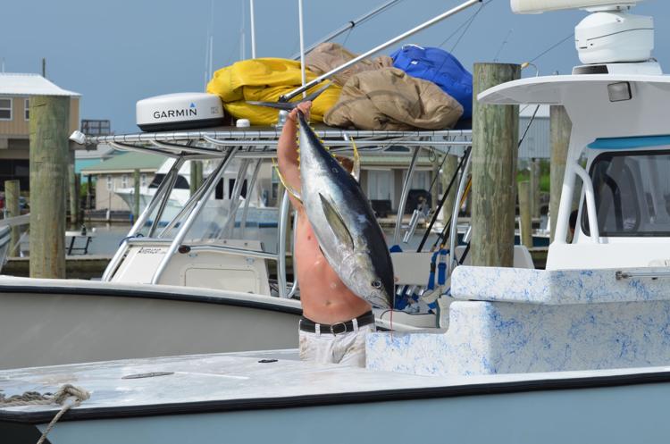
More than 1,300 federally permitted charter boat owners in the Gulf of Mexico are suing the federal government in a class-action lawsuit over an effort to force them to purchase GPS systems to track their movements. The charter boat captains, represented by attorneys at the New Civil Liberties Alliance, are suing the U.S. Department of Commerce, the National Oceanic and Atmospheric Administration, and the National Marine Fisheries Service over a requirement for owners to install GPS tracking devices on their boats at their own expense. The rule, adopted as law in July 2020, requires the owners or operators of permitted charter fishing boats in the Gulf of Mexico to submit an electronic fishing report and states each boat must be “equipped with NMFS-approved hardware and software with a minimum capability of archiving GPS locations.” The law also states, “the vessel location tracking device … must be permanently affixed to the vessel and have uninterrupted operation.” The tracking device must “archive the vessel’s accurate position at least once per hour, 24 hours a day, every day of the year,” and the device must continuously transmit the data to NMFS and the U.S. Coast Guard, according to the law cited in the lawsuit. The equipment necessary costs about $3,000, along with a monthly service fee of $40 to $75. The law became effective on January 5, 2021. Charter boat operators have been using a smartphone app they were required to download to report certain business data, including the charter fee, fuel usages, fuel price, number of passengers, and crew size, though the GPS-tracking requirement was initially “delayed indefinitely,” according to the lawsuit. NCLA filed suit on behalf of charter captains in August 2020, and on February 28, 2022, a district court denied a motion for summary judgement, as well as a request to halt the regulations. The GPS-tracking requirement became effective the next day, and NCLA immediately appealed the decision to the U.S. Court of Appeals for the 5th Circuit. NCLA filed its opening brief in the case last week, and the states of Louisiana, Alabama, Mississippi, and South Carolina, along with two public interest organizations, filed briefs with the court in support. NCLA argues the GPS tracking requirement violates the 4th and 5th amendments and imposes costly and burdensome regulations without articulating how the regulations improve conservation or fisheries management. The lawsuit notes that charter fishing accounts for less than 1% of the total catch in the Gulf of Mexico and less than 3% of the recreational fishery. NCLA also argues the “case poses complex questions regarding an agency’s obligations under the notice-and-comment and arbitrary-and-capricious requirements of the Administrative Procedure Act.” The supporting briefs center on the same issues. “The Final Rule plainly violates the prohibition of warrantless tracking via Government-installed devices recognized by the Supreme Court in U.S. v. Jones,” according to the joint brief filed by the states’ attorneys general. “While preserving the nation’s fisheries is a proper Government objective, the means by which Defendants-Appellees seek to do so must be constrained to constitutionally permissible methods. The Final Rule exceeds these bounds.” “No warrant exception, background principle of property law, custom, or common-law practice renders the physical installation and continuous operation of GPS tracking devices onboard charter fishing vessels reasonable in the absence of a warrant,” the Pacific Legal Foundation wrote. “Thus, without further examination of privacy expectations irrelevant to the Fourth Amendment’s property-rights baseline, [the Fifth Circuit] should enjoin the challenged rule mandating the installation and operation of these devices.” The Buckeye Institute argued the District Court’s decision should be reversed because the GPS tracking requirement “fails to pass constitutional muster” and “does not present an adequate substitute for a warrant because it is not limited in time or scope.” NCLA requested oral arguments in the case to “help the court navigate the complicated legal and factual issues presented.” Republished with the permission of The Center Square.
New $6M water research grant could protect lives, property of Alabamians

Alabamians lives and property may soon be better protected thanks to a new federal grant to help improve the nation’s water prediction capabilities and forecasts. Alabama U.S. Senator Richard Shelby on Tuesday announced that the National Oceanic and Atmospheric Administration (NOAA) has granted $6 million for water prediction research efforts at the University of Alabama (UA) in partnership with the University Corporation for Atmospheric Research (UCAR). “This is excellent news for the University of Alabama, our state, and the nation,” said Shelby. “The research made possible by this $6 million grant will drive scientific advances to help improve the nation’s water prediction capabilities and forecasts. I am proud to have helped secure this funding that will better protect the lives and property of all Americans.” This funding will support the efforts of UA, UCAR, and NOAA researchers to develop 21st century radar technologies aimed at improving measurements of snow and soil moisture. These improved observations will have the opportunity to advance the predictive and prognostic ability of future versions of the National Water Model, the nation’s first-ever continental-scale hydrologic prediction system operated at the National Water Center in Tuscaloosa, Ala. Scientists at the National Water Center will utilize the data produced by the radars to strengthen research and grow the nation’s water prediction capabilities. “This award further demonstrates the University’s commitment to cultivating a research culture that will have a far-reaching impact,” said Dr. Stuart Bell, University of Alabama President. “We are very pleased to see our research efforts making a significant difference for water resources and for the nation at large.” The university will receive $5 million of the funding while UCAR will receive $1 million to support administration and management of the grant.
Conservation groups sue feds to protect Red Snapper, promote reform
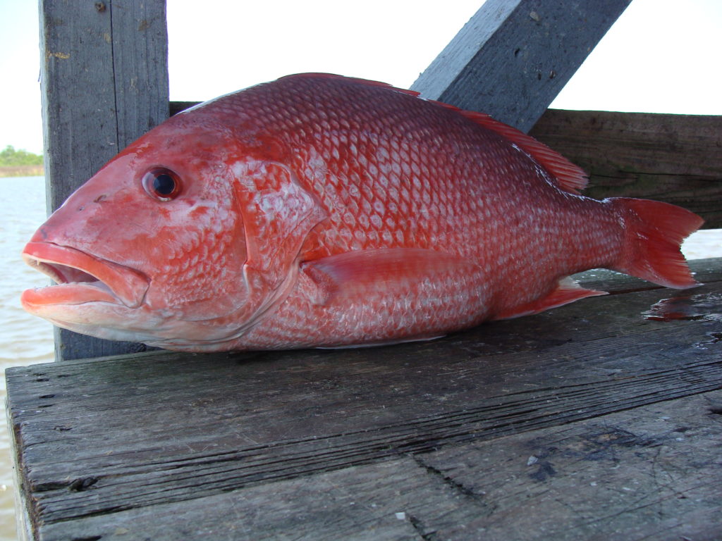
Two environmental groups are suing the Trump administration for extending the red snapper season in federal and state waters within the Gulf of Mexico this year. The Environmental Defense Fund and Ocean Conservancy filed a lawsuit on Monday in the U.S. District Court for the District of Columbia against a U.S. Department of Commerce June decision that allowed recreational anglers to fish for red snapper in federal and state waters for 39 weekend days Friday through Labor Day. According to the groups, the decision “puts red snapper recovery at risk, jeopardizing fishing businesses and recreational fishing for the species. It also violates several provisions of federal law.” “The way we manage recreational red snapper fishing stinks, and saltwater anglers like me are demanding change,” said Robert Jones, Director of Environmental Defense Fund’s Gulf of Mexico Oceans Program. “The recovery of the species is an incredible opportunity. I was recently offshore from Galveston and the water is teeming with red snapper. But instead of anglers and recreational fishing businesses reaping the benefits, we are stuck in a downward spiral of failure. This lawsuit is about catalyzing change.” Jones continued, “Year-round state-water seasons combined with minuscule federal seasons suffocate our access to the best offshore fishing grounds. And I sure as heck don’t want to return to the days when my dad and I could barely find a red snapper due to decades of overfishing. What we demand is innovative, solutions-oriented reform that harnesses new approaches like Louisiana’s LA Creel program, gives us flexible access, and ensures that future generations of Americans can enjoy the thrill of catching red snapper.” The extended season came after the NOAA Fisheries in May approved a recreational season of three days — June 1-3, which fishing enthusiasts decried as being far too short. Alabama lawmakers quickly took action reaching out to federal officials to lengthen the season, which was the shortest ever in the Gulf of Mexico. After extensive debate on both the Gulf Coast and Capitol Hill, the Department of Commerce approved the extended season. According to the lawsuit, Commerce Secretary Wilbur Ross and two federal agencies — the National Marine Fisheries Service and the National Oceanic and Atmospheric Administration — were listed as the defendants.


